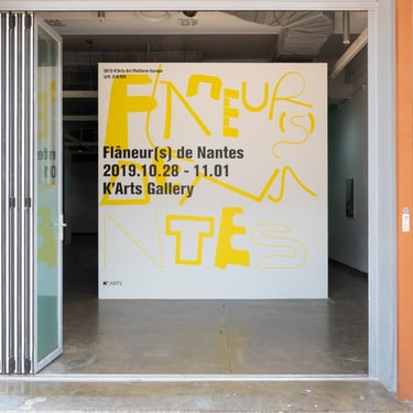
Flâneur(s) de Nantes
낭트의 산책자들
2022.10.21-11.01
Artists : 강다현, 김도연, 김보경, 김태희, 박동균, 양윤화, 이다영, 이준석, 이철호, 이현우, 이혜영, 자수지, 정송, 차민성, 최유은
Location : K-Arts Gallery
2022 K-Arts 플랫폼-낭트
2022 K-Arts Platform-Nantes
프랑스 서부에, 대서양에서 50km를 떨어져 ‘르와르(Loire)’ 강과 ‘에흐드르(Erdre)’ 강의 합류점에 자리 잡은 낭트는 천혜의 지리적 이점을 이용해 일찍이 식민지 교역과 관련된 산업과 조선업과 제조업이 발달했다. 1960년대부터 산업화와 선박 수요의 향상으로 조선업이 크게 성장하였으나, 1970년대 석유파동을 계기로 경제 쇠퇴에 따른 인구 및 고용감소로 프랑스는 조선업은 큰 위기에 직면하였다. 1980년대부터 지방자치단체들은 지역 계획 권한의 자율성이 확대되면서 산업 침체와 도시 쇠퇴 문제를 해결하기 위해 새로운 발전전략을 모색하였다. 1900년대에 이르러, 지속 가능한 발전을 위한 낭트 도시재생의 필요성이 제기되었고, 낭트는 조선업과 항구 관련 유산의 보존, 도시와 강의 유대관계 강화, 생트 안느 지구(Quartier St. Anne)의 버려진 공장지대에 대한 재활용 등에 집중하여 재정비 사업을 추진했다. 낭트는 도시재생 사업인 ‘낭트 섬 프로젝트(Ile de Nant)를 통해 공장시설의 재정비를 통한 도시 하부구조의 확대뿐만 아니라 항구 도시로서의 정체성과 도시의 기억과 유산을 보존하는 재생사업을 진행했다. 지금은 도시재생의 성공적인 사례로 평가받는 낭트는 ‘항구 도시로서의 정체성과 기억과 흔적의 복원’이라는 측면 하에 도시 곳곳에 과거의 기억과 정체성을 재해석하고 새로운 도시로써 성장하는 동력을 멈추지 않고 있다.
<낭트의 산책자들(Flâneur(s) de Nantes)>은 낭트라는 도시가 가진 기억과 흔적들을 역사적 성장과 쇠퇴의 과정, 그리고 과거의 유·무형적 유산에 기대어 바라보기보다 ‘현재’라는 시간의 격차 속에서 적극적인 관찰자의 시선으로 도시가 지닌 기호적 속성과 특수성 그리고 이미지들을 수집하여 도시의 심상을 그리는 여정으로 안내할 것이다.
도시 속 공간과 익명의 장소들을 부유하는 ‘걷기’를 통해 현대라는 환영과 환각의 등장 그리고 옛 신화가 해체되고 부활하는 양상을 읽어내고자 한 발터 베냐민처럼, <낭트의 산책자들(Flâneur(s) de Nantes)>의 작가들은, 일정한 장소에 머무르지 않고 마치 도시의 산책자처럼 낭트를 유랑하며 공간이 품고 있는 시각적 암호들을 수집하고, 해석하는 행위를 통해 도시를 독해해나간다. 베냐민에게 도시는 다양한 인간과 사물 그리고 상황들이 조우하며 기호들이 편재해있는 텍스트적인 공간이었으며, 산책자(Flâneur(s))의 시선으로 도시에 내재한 서사성을 읽어내는 것은 공간을 인지적으로 바라보는 방법이었다.
베냐민에 따르면, “가로는 이 산책자를 아득히 멀리 사라진 시간으로 이끌어 간다. 산책자에게 모든 가로는 가파르게 내려가는 언덕인 것이다. 이 언덕은 그를 아래로 아래로 이끌어 간다. 신화의 어머니들에게로 까지는 아닐지라도 어느 과거로 이끌어간다. 이 과거는 그것이 그 자신의 사적인 그것은 아니지만 더욱 매혹적인 것일 수가 있다.” [M1,2] (W・ベンヤミン 著, 今村仁司・三島憲一 ほか 訳,『パサージュ論 第3巻』, 岩波現代文庫, 2003, pp.77-78)
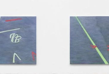
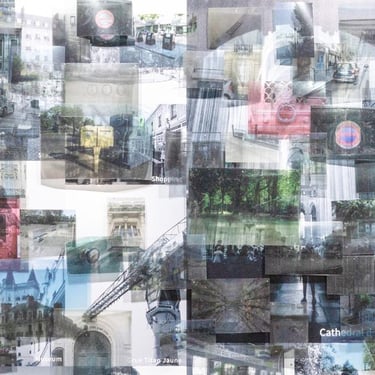
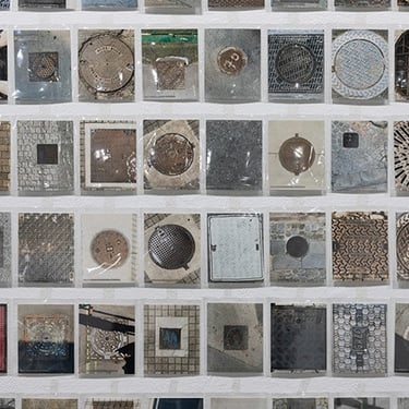
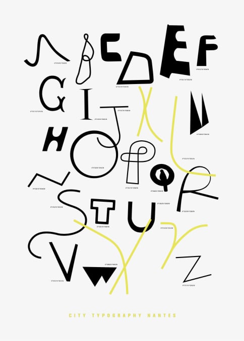
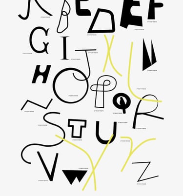
베냐민의 ‘도시 산책자’(Flâneur(s))처럼 작가들은 낭트에서 관상학자이자 고고학자이며 댄디였으며 다른 한편으로 수집가이자 탐정이었다. 그들은 낭트를 여행하는 안내선과 같은 ‘그린 라인’을 따라 이동하며 도시 풍경의 일부인 도로와 건물, 그리고 기념비 등에서 발견되는 반복적인 패턴들을 수집하여 작업의 재료로 사용한다. 그리고 무형의 요소들, 즉 도시 속에서 우연히 마주하게 되는 소음이나, 행인 혹은 특정 형상에서 포착되는 움직임을 채집하여 도시의 인상을 읽어내는 기제로 사용하기도 한다. 마치 고고학적인 시선으로 도시재생 개발 사업으로 변화하고 있는 낭트를 ‘걷는 행위’를 통해 추적하며, 변화된 지형적 흔적들이 겹쳐진 새로운 지도로 제시하기도 한다.
<낭트의 산책자들(Flâneur(s) de Nantes)>은 익숙지 않은 낯선 공간에서 느껴지는 생경한 감흥과 정서들이 적극적인 개입과 시각적 번역의 작업을 통해서 도시를 바라보는 새로운 시각으로 나아갈 것이다. 그 과정에서 도시의 기억과 흔적이 새로운 생명력과 서술 가능성을 갖게 되기를 우리는 기대한다.
우동선 (한국예술종합학교 미술원 교수)
Nantes is in the western part of France, 50 km from the Atlantic coast where the Loire and Erdre rivers meet. Thanks to these geographical advantages, industries such as shipbuilding, manufacturing for export and colonial trade developed in the area. Since the 1960s, following industrialization, there was a large demand for ships and significant growth for the shipbuilding industry. However, population decline and unemployment in the wake of the oil crisis in the 1970s left the industry facing a major crisis. Since the 1980s, local governments in Nantes have sought new development strategies to address the problems of industrial stagnation and urban decline as the autonomy of regional authority has expanded. By the 1990s, the need for urban regeneration was raised for the city’s sustainable development, and the city authority pushed forward a regeneration project that focused on the preservation of shipbuilding and port- related heritage, strengthening ties between the city and its rivers, and repurposing abandoned factory zones in Quartier St. Anne. Through the Ĭle de Nantes Project, Nantes has not only expanded its suburban structure through the re-zoning of factory facilities, but also carried out a regeneration project that preserves the city’s memory and legacy as a port city. Now regarded as a successful case study of urban renewal, Nantes is today seen to highlight its identity as a port city with a focus on the memories and traces of its historic communities, which aim to create positive energy for the city’s growth.
The exhibition of Flâneur(s) de Nantes guides you through the city by collecting its symbols and specificities from the perspective of a proactive observer. It is designed to recognize the gap between the past and present, rather than gazing at the city solely through historic narratives and legacies.
Like Walter Benjamin, who studied the elusive emergence of modernity and the deconstruction and revival of old myths through by in the city, the participating artists constantly explore Nantes to collect and interpret the city’s visual signifiers. For Benjamin, the city was a textual space where various people, objects and circumstances exist, and symbols were interspersed. For Benjamin, reading the narratives of the city from the perspective of a stroller, or flâneur, was a cognitive way of looking at spaces. According to Benjamin, “The street conducts the flâneur into a vanished time. For him, every street is precipitous. It leads downward – if not to the mythical Mothers, then into a past that can be all the more spellbinding because it is not his own, not private.” [M1,2] (Walter Benjamin, Howard Eiland and Kevin McLaughlin trans., The Arcades Project, The Belknap Press, 1999, p.416)
Following Benjamin, the artists in the exhibition were physiognomists and archaeologists, collectors and detectives, in Nantes. They travel along a ‘green line’, which also serves as a guide for travelers in Nantes, collecting repetitive patterns found on roads, buildings, and monuments, which they also use as material for their work. Some intangible elements, such as noises or movements encountered in the city, are collected too. Some trace the changes of the city with an archaeological perspective and reflect them on a map on which old and new topographical features are overlapped.
The Flâneur(s) de Nantes creates a new perspective on the city through active intervention and visual interpretation of the senses and emotions found in unfamiliar spaces. We hope the memories and traces of the city bring the vitality and potential to create new narratives for the city.
Woo Don-Son (Professor, School of Visual Arts, K’ARTS)
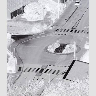
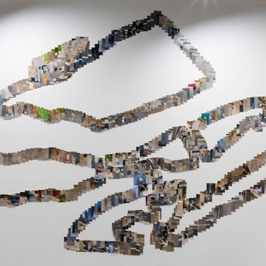
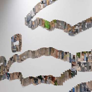
개발 접경지대, 5x7인치 사진 인화, 가변설치, 2019
1759년 낭트 지도에 그려진 섬의 가장자리를 따라 걸었다. 지금 섬 사이에 존재하는 것을 기록했다. 그 사이가 야금야금 메꾸어질 동안 아마도 물은 아무 말도 할 수 없었을 것이다. 침묵은 개발 가능성이 있는 자의 미덕이기 때문이다. 처음 낭트의 모습을 떠올린다. 사라진 물길을 따라 걸으며 수신(水神) 밟기를 한다.
A Border of development area, 5x7inch digital c-print, various Installation, 2019
I walked along the edge of the island depicted on the Nantes map from 1759. I recorded what exists between the islands now. During the gradual filling in of the space between them, perhaps the water couldn't say anything. Silence is a virtue of those with developmental potential. I recall the initial appearance of Nantes. Walking along the vanished watercourse, I step on the footsteps of the Water Deity.*
* In historical Korea, which revolved around agriculture, there was a tradition known as "jisinpapgi," or stepping on the deity of the land. In Chinese characters, "ji" means land, and "sin" refers to a divine being. “밟기(papgi)" is a noun meaning stepping or treading.This tradition was part of the folk games held in Yeongnam on the lunar January full moon day, also known as Daeboreum. Villagers, led by a farming music band, would go from house to house, appeasing the spirits that govern the land to pray for safety throughout the year. The homeowner would treat them with food, grains, or money. The author imagined transforming the land into water and envisioned "susinpapgi," stepping on the deity of water.
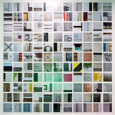
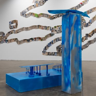
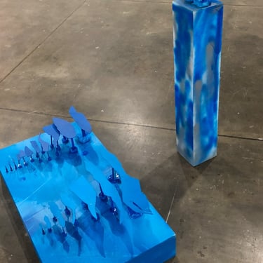
물이 지나간 자리, 아크릴에 라커 스프레이, 2019
시대별 낭트 지도를 수집한 뒤 육지를 오려 면적에 따라 점진적으로 배치했다. 다양한 크기의 육지가 하나의 덩어리로 변모하는 과정을 시대별로 배치하여 낭트섬의 지형변화를 직관적으로 이해하고자 했다.
The site where the water is gone, Acryl with Aerosol Spray Paint, 2019
After collecting Nantes maps from different periods, I cut out the landmasses and arranged them gradually based on their respective areas. By arranging the landmasses of various sizes according to their respective periods, I aimed to intuitively understand the changes in the terrain of Nantes Island as smaller landmasses transformed into one cohesive entity.
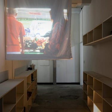
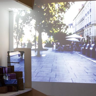
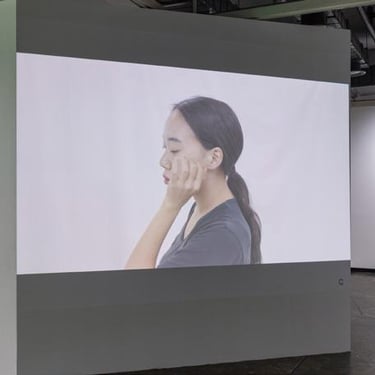
물길, 단채널 비디오, 5min, 2019
물길은 일 드 낭트(île de Nantes)섬을 자유롭게 둘러 흘러나가곤 했다. 가끔은 땅 속에 스며들기도 하고, 가득 찼다가는 영영 사라지기도 했다. 아직 낭트에 남아있는 물을 따라 물길 지도를 그려본다.
Water ways, single channel video installation, 5min, 2019
Waterways used to freely flow around the Île de Nantes. Sometimes they would seep into the ground, and at other times, they would fill up and then disappear forever. I attempt to draw a map of waterways still remaining on Nantes, following the water that remains.